Introduction
Before Camargo was ever formed the area was a favorite Indian fall and winter hunting grounds with a mix of bountiful game. Deer were found in what was thought to be unlimited abundance. There were also 'prairie chickens,' partridges, wild geese and ducks to easily be obtained. The rivers provided good fishing for a true palatable variety. Since the many different bands of Indian preferred the natural habitat provided by timber camps were made near river banks rather than out on the open prairie. The area itself was not considered by the Indians to be good for farming or settling. No one tribe claimed the lands of the Grand Prairie. In the spring it was time to return north, to Ohio, where they planted fields of corn.
Camargo is situated in the north central portion, section 34, of what is known today as Douglas County, Illinois. The county would not be formed until 1859, 30 years after our story begins and 23 years after the original town was "laid off" by Isaac Moss with the help of Joseph Fowler, a surveyor. New Salem was the first name Isaac associated with the area in 1836. When he made an addition in 1840 the name was changed to New Albany. The voting district was recorded simply as Albany. Upon the suggestion of Col. J. B. McCown (of the voting district committee), the name of the voting district was changed to Camargo. Named after a town in Mexico, Cabo San Lucas way, the settlers living near the township adopted this name and New Albany finally was known to all as Camargo Township. Camargo was the only township mapped out in an 1850 railway map of northern Coles County, the county Douglas would be laid out from 9 years later.
Camargo is easily the oldest district, formed 17 years before Bourbon Township. Eight years before Isaac Moss laid out New Salem there was a visit by two hunters. One would return with his family, impressed with the abundance he witnessed and the land costs he could more easily afford. This skilled hunter would be remembered as the first white settler of Douglas County. The second cabin he built would become a historical landmark. His name was John A.Richman. He would be joined by the Gill, Hammet, Bragg, Watson, Moss and Murdock families. According to the "Historical and Biographical Record of Douglas County, Illinois" (John Gresham, 1900), these were the first families to reside in Camargo.
My search began as an innocent genealogy project for a line on my wife's side. She had a great-grandmother Dora who was born to Andrew Jackson Richman in 1867. Recorded as being born in Camargo, Douglas Co., IL my path turned toward the path of an original pioneer, Dora's grandfather, John Jackson "Uncle Jack" Richman. Mr. Gresham's 1900 words reached within me to deliver amazement, "The original pioneer of Douglas County was John Richman, who, in 1829, settled in Camargo Township. He was a native of Greenbrier County, West Virginia, and came with his father when a lad of sixteen years to Vermilion County, Illinois." There was no doubt that this was the Richman family I was looking for. The names and dates were all either matching or as close as some older family records tended to be.
As my record verification started in earnest I received or discovered other writings and recollections of Uncle Jack and his colorful father, John A., whom I consider to be the true, original pioneer to actually settle on this grand prairie. There are several detailed accounts of the trek of the Richman family, with minor variations. Each new version rooted deeper in me an appreciation for this family as well as those who moved in with them as well as around them.
One question was why? Why did John A. choose the prairies of Illinois where no other had dared laid roots before? From the journals or Dr. H. Rutherford, one of few doctors in the territory in the early 1840s, we learn of John A's youth. Dr. Rutherford writes, "From the late Andrew Gwinn I learned that his (John's) father was a woodsman by profession, what the French term a courier de bois." He also shares, "His youth and manhood had been spent in the mountains of Virginia, living a wild and savage life."
Now, his father, William Cody Richman, served from Oct. 1775 to Nov. 1777 with the 3rd Virginia Regiment, commanded by Col. Neville of Botetcourt County in Virginia. Not quite two years after this service he and his first wife, Mary, were blessed with the birth of young John. He was the eldest of 10 children and grew strong and tall. His father relied on him, no doubt, to help with the work that put food on the family table. Yet, there was the nagging connection between a woodsman and living a wild and savage life.
William Cody was a landowner in Virginia. He made three separate acquisitions from November of 1793 to Jun of 1800, totaling 290 acres in what was known as New Richmond, near Richmond Falls. The name was respected among the community, just as John A. and his son were always respected in Camargo and Douglas County. The other siblings seem to have had the advantage of a degree of formal education yet this was not the education John received. Why?
Turning to the trusty Columbia Encyclopedia the connection began to make sense. When Dr. Rutherford made reference to the occupation of William, as told to him by friend Andrew, he sounded the words in a normal tongue. A woodsman, what the French called a " courier de bois."
Here is what the French call a 'coureurs de bois.' These were woods runners, unlicensed traders during the French regime in Canada. Based on the encyclopedia; "Traders were required to be licensed, but to only a favored few were licenses granted. The coureurs de bois defied regulations and ventured into the Canadian wilderness. Although they stimulated the growth of the fur trade and the exploration of Canada, their defiance caused poor relations with the Native Americans, to whom they sold liquor."
Based on the fact that the characterization and "trade" was begun long before William came to be it is likely his skills were passed on to him by his father, John or his grandfather Joseph Richmond, who was born about 1700. Be that as it may, we can clearly begin to see the training of our first white settler in Camargo. None of the common fears of the day would have given John A. or his friends much concern. Indians were not feared but sought as trading partners. Hunting was second nature and a night outside of the protection of cabin walls would likely be more a treat then treacherous.
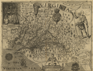
Virginia - 1624
---------------------------------------------------------------------------------------------------------------------------------------------------------------------------------------
The Hunter Moves
As William's family grew new ventures came into being. The land William acquired was situated on both sides of a river with an island in the middle. The island was referred to as Jake's Island after John's younger brother Jacob. Family members operated a ferry service from the Richmond homestead. Ancestors of William still ran the operation into the 1970s.
This wasn't 1970 however and John had two reasons for wanting to move to different lands. The cost of land around Richmond Falls was escalating higher then he cared to calculate. In addition, John had picked up a side interest that only a handful ever mastered, bee hunting. He was considered an expert in this art but the hunting was mighty slim in Virginia at the time. Rumors of large groves of bee trees further west sparked, no doubt, ideas of moving.
In 1671 there was an English expedition led by Thomas Batts and Robert Fallam. Upon reaching the New River they began to carefully explore the New River valley. It descends the river to Peter's Falls on the future Virginia-West Virginia border. It was then that they claimed for England all the land drained by the New River and its tributaries. These were the lands the first settler was raised. Its tributaries would be a major part of the highway he and his 'expedition' would use to "spy the land" a bit west.
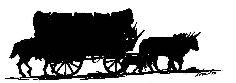
As John and Susanna prepared for their journey a final destination was thought to be the Wabash County area of Illinois. John's experience as a wood runner would, I am ascertaining, have been a great comfort to all involved. Whether or not all pioneers from New Richmond traveled together at this time we know some friends as well as family are resting near John in Illinois. His father seemed to have full understanding. Judging from the history the eldest son was just doing what they did, securing further opportunity for future generations. He was doing what a good father, provider and hunter would do, He was hunting.
Today we check the Internet. After punching in a bit of information we can learn that Sandstone, WV is 417 miles as the crow flies. Equal to 671 kilometers and 362 nautical miles. Their initial heading would have been set to West - Northwest 291.9 degrees. The driving directions are simple, although neither location is even today a large destination. The couple prepared for a year.
There are four major accounts I have so far been privileged to read, many times over. The one source is to me unknown yet the overall information is surprisingly accurate in events so I am positive we are reading a unique view on the same family. One is recorded in the Illinois Historical Edition, "Douglas County Biographical, 1910." The third is from the recollections of Andrew Gwinn and John A as recorded in the memories of Dr. H. Rutherford in the early 1840s. The fourth is a view after the rivers while traveling over land to their first major stop, the Vermilion River valley 50 miles Northeast of Camargo. There are other stories relating briefly of the first family of Douglas County but the details from these four accounts paint a wonderfully clear picture of how difficult this journey would be.
Susan was John's second wife. In 1795 he married Jane McCoy. As known, they had no children. She was the daughter of James and Jane McCoy. If any of you know more about the McCoy family or about Jane McCoy I would be interested in hearing from you. From records of the day a number of fates could have intervened while opening the path for Susan to marry John on Tuesday 12 July 1803. It was a half-moon lit night a full 23 years before leaving their only known home. In 1826 John and Susan sold property in Richmond Falls.
Dr. Rutherford gives us this quick snapshot of Susan. "John was the eldest son and had the good fortune to marry a woman of exceptional wisdom and patience. It was said of that no other woman could control his passionate fits." Deciding to live in Wabash County, Illinois the "energetic, industrious and prosperous" couple set about the task of building their raft.
Two large poplar trees were chosen to hewn out two large canoes. Upon the canoes they fashioned a platform on which they built their tent and had enough room to carry supplies. Keep in mind they also were recorded as leaving New River Falls on the catamaran styled boat "…with his ox, household goods, and one covered wagon." They knew the river would take them a great deal of the way but traveling over land was inevitable in order to reach their destination.
There were nine children in all with their youngest, Lewis, an infant. They were launching from New River Falls on the New River. The family was intimately familiar with much of this land, having hunted and roamed the mountains their entire lives. Each account reads a bit nonchalant in how they "floated" down the New River until it joined the Gauley River to form the Kanawha River near Charleston.
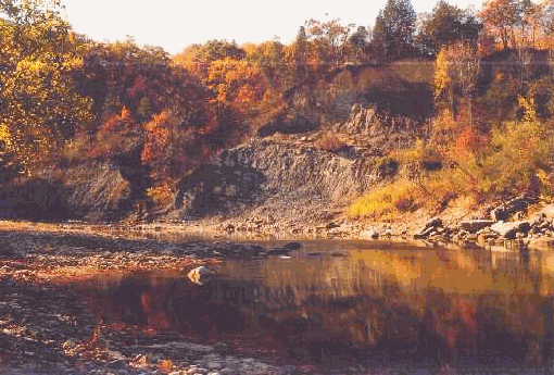
That is how their first leg of this journey is described. The New River is actually one of the oldest known rivers in North America. There are six stages identified along the course of the river. John and Susan, with family in tow, began their journey from the third stage at modern day Sandstone, West Virginia. This was the portion of the river running through William's land and was also the section they operated the ferryboat, which the eldest son would make good use of.
The first fifteen miles has several impressive rapids interrupted long expanses of flat water. At this stage the river is both beautiful and very powerful. The long expanses would give the family time to check all the goods while preparing for the next rapids. Dr. Rutherford recounts, "The boats were pushed along with staves; holding back half the time as the stream was so swift and narrow in places it was too dangerous to really travel.
Too dangerous is a good characterization when considering the fourth stage, Prince to Thurmond. There are fewer rapids and longer flatwater pools in this 15-mile stretch. Yet those rapids are considered more dangerous than found on the upper portion and are characterized in the book, "Wild Waters of West Virginia" by Welbridge, as "unwise for novices or open boats to proceed at this higher level." Again, John A. and his older sons were not novices but the craft they had assembled was definitely an open boat.
Ahead, during the last 8 miles of the New River leg, there were six to eight foot waves, holes, stoppers and whirlpools. "The entire river flows through an immense gorge with extremely rugged mountains and cliffs in view all the way." No emergency off-ramps, no cellular communication, no time to worry about anything but surviving the rapids until the calmer waters of the Kanawah River could be reached.
Kanawah County was formed from parts of Montgomery and Greenbrier Counties. The later being the county of John's origin. Charleston was the nearest large town and activity was brisk during the period this family drifted through. It was known as salt country with salt production in a major boon due to technological improvements in boiling methods, kettles, furnaces and drilling methods. I have no doubt why Charleston did not offer an attractive end for John. Bee trees were not widely accessible.
The Kanawah empties into the mighty Ohio River near Gallipolis, Ohio. The "City of the Gauls" began as a French land speculation sale in France by the Scioto Company. Many middle-class French citizens invested money in land deeds hoping to make great fortunes in America. They had no understanding of the hardships associated with frontier life. After a long ocean journey the "French 500" arrived 17 October 1790 to find their deeds were worthless.
Petitions were presented to Congress and George Washington. Arrangements were made, lands secured and despite all the obstacles these French pioneers built a thriving river trade. In 1803, the year of John and Susan's wedding, the county of Gallia was formed as a means of honoring these early residents.
For John and Susan Gallipolis marked a major turn west. I wonder if John could begin to smell the honey awaiting him. The Ohio River would take them along the southern border of modern Ohio. When the Ohio reached the Wabash they would have to turn upstream. This was now the middle of summer. Again turning to Dr. Rutherford, he writes, "In the low water of summer he and his sons pushed the flotilla upstream, day after day, till they reached Eugene."
I must note at this point in their journey several references being made to more than one craft. In one account John and Susan built rafts. In another there was talk of boats. Finally, Dr. Rutherford mentions a flotilla. All these lead me to believe the Bradshaw family; other siblings and friends may well have been involved in this initial trek. Again, please feel free to fill in any gaps noticed in this version of their journey. Doing so will make the next even more exciting.
It is after several hard days journey upriver that Dr. Rutherford has our family resting for a two-year period. However, other accounts show this merely as the place they once again took to land. In Gresham's 1900 compilation we read of their arrival to Vermilion River, "…over tedious roads of the frontier in wagons accompanied by a drove of sheep, horses and cattle." There are at least two accounts John's oldest son, Uncle Jack, stayed the first summer in Ohio with the herd. Young John Jackson was a lad of but sixteen years at the time. We also have accounts of the family living in their tent on a rented farm for two to three years. This was their destination, or so they believed it to be.